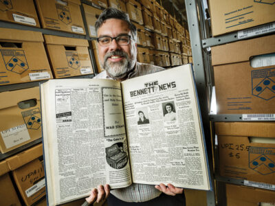
Some remarkable visual details fill out the 40-some maps that comprise Renaissance City Views from Above and Afar, an exhibition at the Van Pelt-Dietrich Library’s Kamin Gallery that runs through August 13.
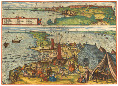
In the views of Cadiz (above), the upper image shows the city’s fortress on the right and, on the spit of land to the left, a pair of watchtowers designed to warn the town of raids by pirates and “to alert fishermen to the arrival of schools of fish.” The lower view, notes the catalogue, shows “various aspects of the catching, processing, and disposal of tuna, one of the town’s major industries.”
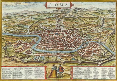
The west-facing view of Rome (below) shows the city partially enclosed by the Aurelian walls from the third century CE. Saint Peter’s Basilica (begun in 1506) is not visible, but the Papal Palace, as well as the obelisk from the circus of Caligula and Nero (where Saint Peter was executed), the Vatican, and the Castel Sant’Angelo (Hadrian’s Tomb) can all be seen on the left.
Nearly all of the maps—which were drawn from the Civitates orbis terrarum (the six-volume atlas of the world’s known cities published between 1572 and 1617)—were lent to the library by Jack and Barbara Sosiak GNu’66, who began collecting maps and city views years ago in the course of work-related travel in Europe. The exhibition was co-curated by Jack Sosiak and Daniel Traister, curator for research services at Penn’s Rare Book and Manuscript Library. —S.H.