Tours by three University Museum archaeologists of their respective digs.
THE UNIVERSITY MUSEUM’S first-ever expedition — to Nippur, the holy city of the ancient Sumerians and Akkadians — began less than auspiciously. John Peters, a professor of Hebrew at Penn and leader of the expedition, reported, “Early in April 1889, when we had excavated but two months, an end was put to our work, growing out of the conduct of one of the Commissioner’s Turkish guards in shooting an Arab who was trying to steal by night the mules of the guard. Our camp was burned, we were robbed, and a bloodfeud was established against us. So closed the first year.” Nevertheless, the site at Nippur eventually yielded an astonishing treasure-trove of cuneiform tablets that have largely supplied what is now known of Sumerian literature. And in the 1920s, joining with the British Museum to excavate ancient Ur, the Museum uncovered the spectacular 4,500-year-old Royal Tombs of Ur, artifacts of which it retains on permanent display.
In
addition to becoming a world leader in Mesopotamian excavation and
research, the University Museum today is an internationally renowned
institution that has conducted archaeological and anthropological
investigations into the peoples and history of every continent on Earth.
Early in this century, intrepid field ethnologists like William Curtis
Farabee, Henry Usher Hall, and Louis Shotridge braved the impassable
Amazon basin, described daily life in the tribes of remote Siberia and
West Africa, and retrieved oral histories and artifacts of vanishing
Native American ways of life. Throughout its history, the Museum has
pioneered in applying the latest scientific techniques, sending an
aerial expedition in search of Mayan ruins, installing one of the
world’s first radiocarbon-dating laboratories, and conducting an
underwater excavation of a Bronze Age shipwreck off Turkey. Its
expeditions have also shed light on little-known civilizations such as
that of the Phrygians (the people of the legendary King Midas).
Important long-term excavations of ancient cities have included Abydos,
the burial place of Egypt’s First Dynasty kings, and the great Maya
center of Tikal in Guatemala.
Here are “reports from the field” for three current projects — in Syria, India, and Belize — based on presentations made at the Museum’s annual Members Lecture and Dinner last fall. They vividly convey both the excitement and the tedium of archaeological investigations, the continuing role of serendipity in making important discoveries, the educational value of fieldwork for students, and the day-to-day business of living at a dig — learning to eat unfamiliar food, finding a place to do laundry, or passing the time by playing cards.
A Bronze Age Cemetery Under a Barley Field
Tell es-Sweyhat, Syria
By Dr. Richard L. Zettler, associate curator-in-charge, Near Eastern Section
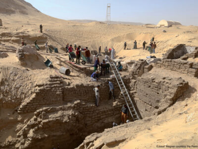
SEVEN YEARS AGO, we embarked on the Museum’s first-ever foray into Syria, beginning excavations at a site on the east bank of the Euphrates. We’ve been reconstructing the layout of Tell es-Sweyhat, an ancient city that by ca. 2100 BC had become a bustling urban center. Assisted by over 25 undergraduate and graduate students from Penn and other universities, we’ve uncovered important insights into the late third millennium in northern Mesopotamia, a period that hasn’t been well documented. Our excavations are helping to fill a gap in the historical and archaeological record.
A
few years ago our research took an unexpected turn when a mishap led to
an exciting discovery. In the spring of 1993, we found that the
northwestern portion of our site had sprouted waist-high ripening
barley! The local landlord had irrigated, and we were effectively
prevented from working in at least one of our excavation areas. But our
dismay turned to interest when we noticed the irrigation water had
opened up three deep holes in the ground.
Early
one morning Michael Danti, a Penn graduate student in anthropology,
squeezed down into one of the holes, tethered by a rope and armed with a
flashlight. He stopped on a kind of landing, from which his flashlight
revealed a domed-ceilinged chamber. We asked if he could see anything —
all hoping he would repeat Carter’s famed response to Lord Carnarvon
upon opening the tomb of Tutankhamen: “Yes, wonderful things!” He didn’t
— but he did spot the tops of several pottery vessels protruding from
the fill in the chamber. We had discovered Tell es-Sweyhat’s Early
Bronze Age cemetery!
We
excavated two tombs in 1993, but local looters had beaten us to the
punch (they left behind cigarette packs and a lighter). A third tomb —
which proved intact — was explored by our team two years later, and
yielded some fascinating artifacts. The excavation was undertaken by two
Penn graduate students in anthropology, Jill Weber and Brad Bentz, with
the help of our archaeobotanist, Naomi Miller of the Museum Applied
Sciences Center for Archaeology (MASCA), which uses various methods to
date cultural materials, and Peter Roberson, a student at Purdue
University.
The
chamber contained two articulated skeletons, both female, one with her
jewelry in place. More human bones were scattered around the floor, with
a large pile against the north wall, apparently tossed aside when the
newly dead were interred. Our tomb contained at least eleven bodies. We
were looking at a family burial — if the biblical account of Jacob’s
instruction’s to his sons at his death (Genesis 49: 29-33) can be taken
as documenting similar practices in the Levant: “[H]e gave them these
instructions, ‘I am about to be gathered to my people. Bury me near my
fathers, in the cave that is in the field of Ephron the Hittite.”
We
also found the remains of funerary offerings, including the bones of a
piglet and sheep or goat heads. In addition to jewelry, the tomb yielded
pins for securing garments or shrouds; daggers, axes, a javelin head,
and spear butts; bone cosmetic containers with incised designs, a flint
core, a model of a four-wheeled covered wagon, and more than a hundred
pottery vessels. Although we sieved the contents of the vessels and used
flotation to recover any plant remains, only one jar gave a hint of its
original contents: a large number of birds the size of modern pigeons.
Tell
es-Sweyhat’s tombs, which we know from the pottery date to 2500-2250
BC, consist of a 2 meter deep rectangular shaft that provides access
into a 4 by 5 meter oval chamber. The chambers are high enough to stand
up in, but their tops are 2.5 meters below ground. The tombs are cut
into sterile soil and are stable, so we worked inside them, stringing an
electric light powered by a small generator on the surface.
Conditions
were cramped and the pace of work slow. On any given day two or three
students were inside digging with small tools and brushes to loosen the
soil around crumbling bones and artifacts, while workers from a nearby
village handed up basketfuls of soil. The soil was sieved before being
discarded. Documentation — photography, in particular — has been a
major problem because of the low light.
The tomb is intriguing but archaeologically not unique. For us the really exciting story is the size and potential of the Tell es-Sweyhat cemetery. It’s spread over almost two acres, and there may be 100 to 150 tombs. This gives us an unparalleled opportunity to study the population of the settlement, as opposed to just their refuse and isolated possessions.
Life in One of India’s First Urban Societies
Rojdi, India
By Dr. Gregory L. Possehl, curator-in-charge, Asian Section
THE ARCHEOLOGICAL SITE of Rojdi, which the Museum has been excavating since the early 1980s, was part of the Harappan civilization — ancient India’s earliest literate, urban peoples. The best-known city of the Harappan civilization is Mohenjo-daro, 400 miles to the northwest on the Indus River, in Pakistan. The ancient city of Harappa is also in Pakistan. We’ve been conducting our dig at Rojdi, which is in the Indian state of Gujarat, with the Gujarat State Department of Archaeology. About 25 Penn students have participated.
Our
field work at Rodji takes place in December and January, when the
weather is 85 degrees and clear. We live in tents at the site and have a
small kitchen staffed by Brahmin women from the nearby village of
Srinathgadh. Many Gujaratis are vegetarians and we respect this
tradition in our meals. The students who have come to Rojdi have learned
to enjoy Gujarati food, which is served on a traditional metal dish
called a tali. We excavate from 8 a.m. to 5 p.m., with an hour
for lunch, Monday through Friday, and spend weekends in the city of
Rajkot, taking care of laundry, shopping, and other necessities. As for
leisure activities, the Rojdi
project has a reputation for developing highly skilled players of the
card game Hearts.
One
of the most basic issues we have tackled was the date of the site.
Radiocarbon-dating places the occupation of Rodji from about 2500 to
1800 BC, which would make the village contemporary with Mohenjo-daro and
Harappa. This overall period includes two distinct phases of
occupation; a later one, which we call Rojdi C, occurred in 2000-1800
BC.
An
impressive section of the village’s plan has been uncovered: whole
houses, courtyards, food-grain threshing and storage areas. Judging by
the size of the houses at Rojdi, we believe they were lived in by
nuclear families, with room for a few other relatives such as
grandparents or the brothers and sisters of the primary occupants. They
are not the homes of extended families like those seen in India today.
However, like the farmers in 20th-century Gujarati villages, it appears
that the villagers kept their animals close to their houses.
The
development of animal husbandry and agriculture in South Asia is a
particular interest of mine, and a significant portion of our research
was devoted to recovering animal bones and plant remains. The report on
animals is being prepared by Kathleen Ryan, G’86, of MASCA. She
has found that the people of ancient Rojdi kept cattle, along with some
sheep, goats, and pigs. Butchering marks and burned bone lead us to
believe they were not vegetarians. We’ve also found the remains of
chickens, first domesticated in South Asia. The Rojdi villagers
apparently were hunters as well as farmers, and they supplemented their
diet with wild animals including elephants, a type of wild dog, and a
good selection of the local deer and antelope.
Steven Weber, Gr’89,
has used a system of flotation to recover well over 10,000 ancient
seeds from the site. According to Weber, the ancient Rojdi farmer used a
wide variety of hardy, drought-resistant plants that required little
care or cultivation. These plants, which aren’t well known in the West,
include two indigenous South Asian millets, three forms of gram, four
peas, and a bean. Of particular interest is the fact that three other
millets present at Rojdi — sorghum, pearl millet, and finger millet,
which account for about 20 percent of all food grains in India today —
actually originated in Africa. Their appearance at Rojdi and other
Harappan sites demonstrates how early they were integrated into the
local foods, and testifies to the seafaring and trading skills of the
Harappan peoples, whose ships sailed as far as Mesopotamia, and south to
Africa at the mouth of the Red Sea.
Another notable observation that has emerged from Rojdi relates to theories of the so-called eclipse of the cities of Harappan civilization. It has been shown that Mohenjo-daro and many other Harappan sites were abandoned, or shrank dramatically in size, at around 2000 BC. But in investigating Rojdi C, we found that this settlement grew and was in fact completely rebuilt during this period. Our findings are an important reminder that the transformation of ancient urban systems is a very complex process, and events in one region may not be replicated simultaneously elsewhere.
Secrets of the Stone Maiden
Xunantunich, Belize
By Dr. Wendy Ashmore associate curator, American Section
EACH YEAR, SOME 16,000 people visit Xunantunich to ponder the ridge-top ruins towering over this part of western Belize. Wear patterns on grass and stone testify that most people cross directly to the Castillo, a 45-meter-high pyramid, and then climb up various distances to view the magnificent panorama. At least a century ago, the pyramid acquired a legend in which a maiden appeared miraculously at its side and then quickly vanished. The site came to be known as Xunantunich, “the place of the Stone Maiden.”
In
1991, the Government of Belize invited Richard Leventhal, director of
UCLA’s Institute of Archaeology, to develop a project of archaeological
research and architectural consolidation for Xunantunich. Leventhal
asked me to join him in this effort and organize a settlement survey.
With support from Penn and the National Science Foundation, five Penn
doctoral students and I became part of the team. After a pilot season in
summer 1991, the Xunantunich Archaeological Project (XAP) has conducted
four-month field seasons annually from February through mid-June, with
the collaboration each year of up to 15 North American students and 60
or more local residents.
From
the start of the project, we felt that the issues we could best address
would involve the famous collapse of Classic Maya civilization of the
ninth and tenth centuries AD Previous work had shown that Xunantunich
was occupied during this critical time, so we decided to look at how its
rulers responded to potentially mounting stress, and at the impact on
the farmers in the adjoining countryside.
Established
evidence had suggested that Xunantunich was but the latest in a series
of small political and ritual capitals in the area. Any given capital
apparently ruled for no more than a few centuries’ time, but
collectively they spanned some 1,500 years.
We
propose that Xunantunich seized local power starting in about AD 800.
The Castillo was clearly the focus of activities, and we have documented
its fragmentary stucco frieze, originally uncovered in 1950 by Penn’s
own Linton Satterthwaite, Gr’43. Virginia Fields of the Los
Angeles County Museum of Art interprets the sculpture’s themes as
rulership and accession to power — certainly apt messages for the
building of a self-consciously royal center.
But
within a generation or two of the initial takeover, spacious public
arenas south of the Castillo already lay abandoned. The formal plaza
north of the Castillo became more divided and enclosed, as if
progressively restricting the audience for political and religious
activities. The plaza farthest north (where today’s visitors enter the
main ruins) was nearest what we think were the royal residential
quarters — an elevated compound, itself increasingly shut off from the
rest of the site.
In
the surrounding countryside, the XAP survey crew — including four Penn
doctoral students — has mapped a series of ancient villages, each
built around either a small pyramid or an unusually large residence. One
of the largest villages, Actuncan, stands out for being within a
kilometer of Xunantunich and for boasting a pyramid 27 meters high.
First investigated 30 years ago, Actuncan has now disclosed to us some
elaborate stucco masks on the pyramid face, dating back half a
millennium or more before Xunantunich’s heyday. It also yielded a
fragmentary carved stela, dated by its style to the first centuries AD
Actuncan seems the likely local predecessor of the ridge-top center of
Xunantunich.
We also studied the abundant terracing on nearby hillslopes, and believe that the scale and forms of the terracing and adjoining house remains suggest agriculture was controlled by the farmers themselves, not their kings. Generally, Xunantunich’s landscape was a fertile one, and the city’s specific location astride key Belize River tributaries had long-term strategic advantages. Still, the turbulence of the Classic Period collapse must have ultimately overwhelmed the local residents, and by perhaps the eleventh century, the crumbling “Stone Maiden” stood as a mute reminder of people who had thrived in the area for more than 1,500 years.